Travelblog SA#29: El Choro Trek – Bolivia

13th-15th November 2018

Dropped off by the shore of Laguna Strellani with a backpack full of camping gear and all the food I will need to eat for the next few days, I was at the beginning of the El Choro trek.

SAMSUNG CAMERA PICTURES

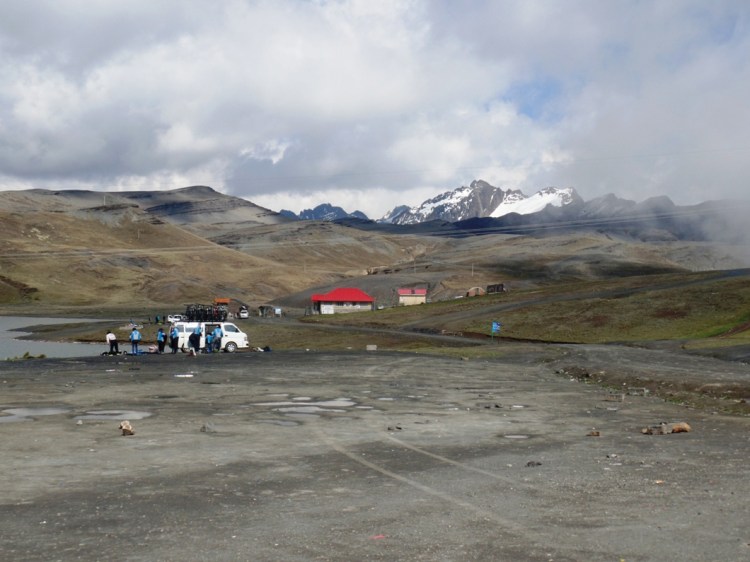
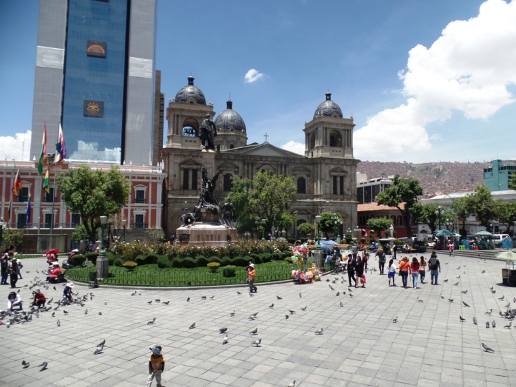
After passing through a car park full of tour groups getting their bikes ready to ride down the ‘World’s Most Dangerous Road’, I reached the ranger station where I signed in. I noticed that there didn’t seem to be too many other entries in the book in recent days. I had heard this was a popular hike, but Bolivia does receive significantly fewer visitors than Peru and we were entering the low season.

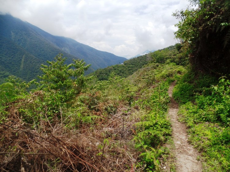
I began upon the trail, looking forward to the idea that this was a walk where I would get to experience some solitude.

SAMSUNG CAMERA PICTURES

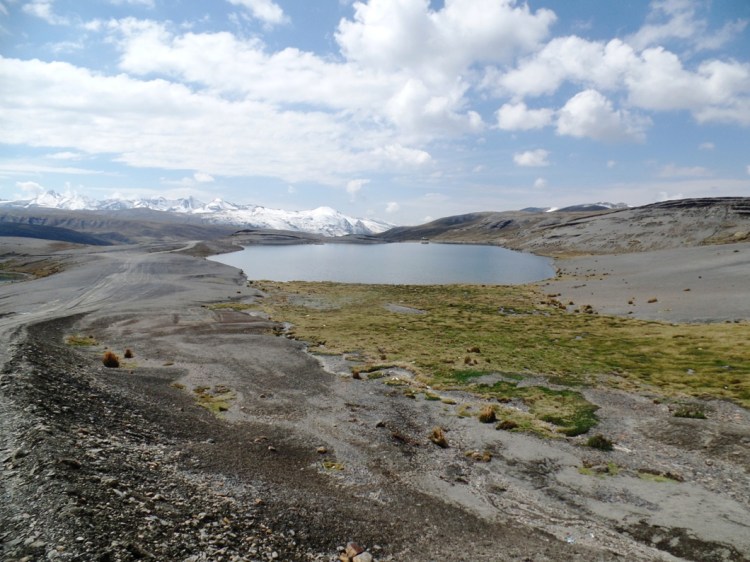
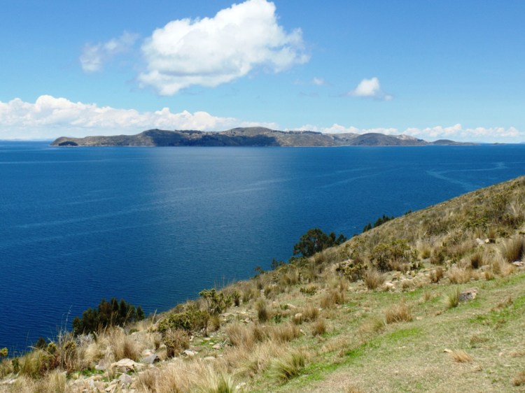
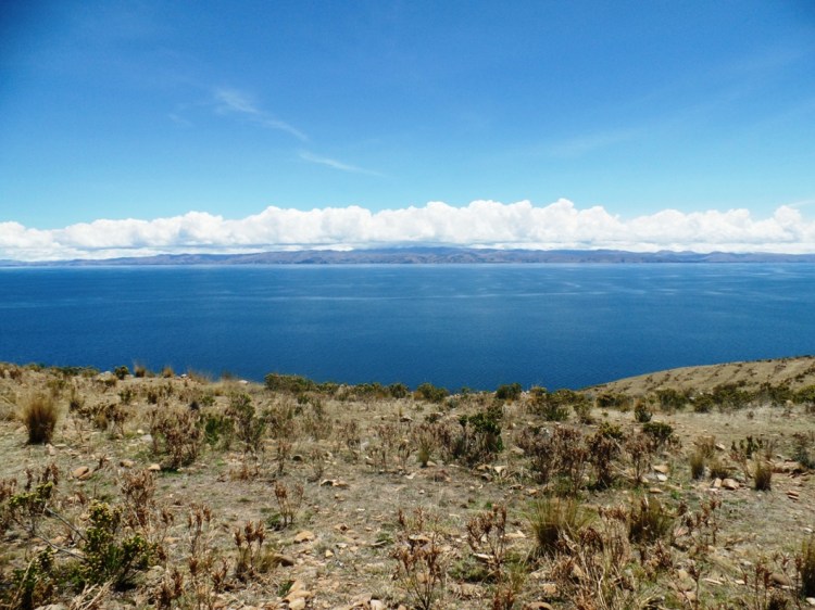
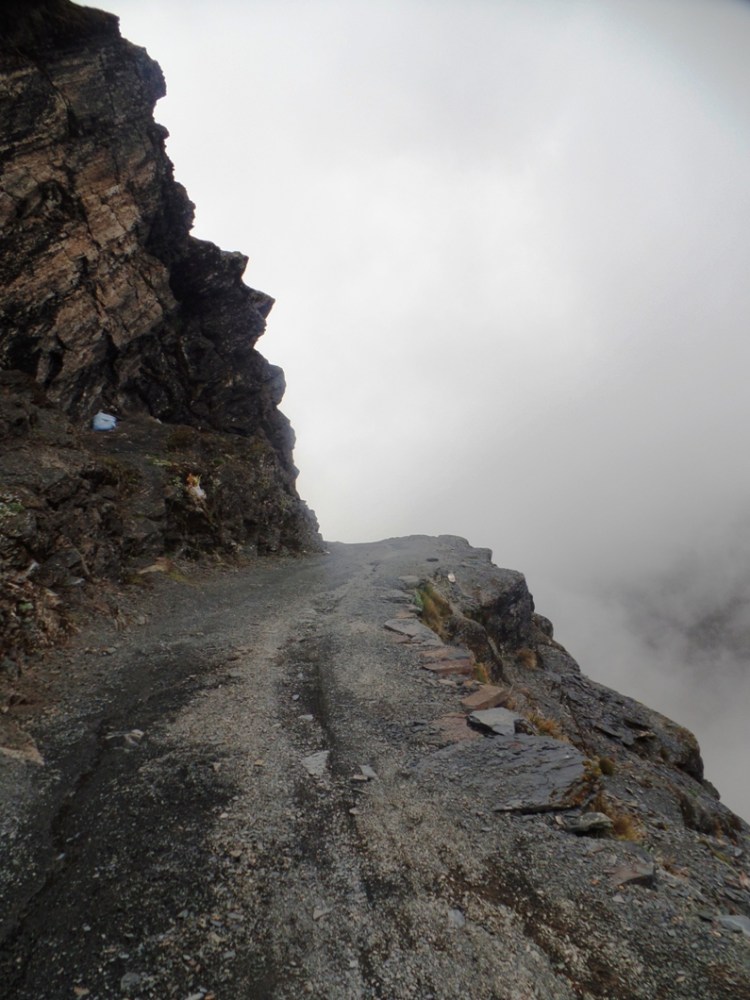
At around 4,500 meters altitude, the air was thin and I was rather breathless on my way up the pass. Once there, I was engulfed by clouds, totally obscuring – what I guess to be – the amazing views at the top, but I guess you can’t always win them all.

SAMSUNG CAMERA PICTURES

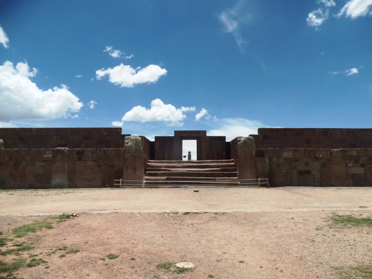
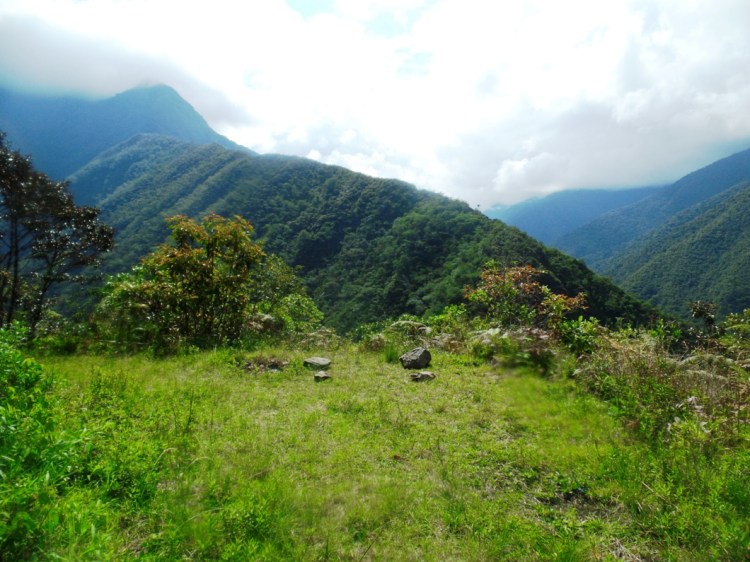
From the pass, the trail snaked down into the valley. Eventually, I reached a green meadow where there were some old ruins and a woman was herding llamas. She was the first person I had seen for a couple of hours and I didn’t see anyone else until over an hour later when I reached the tiny village of Chucura, which was the next checkpoint. A man got me to sign my name in his book.

SAMSUNG CAMERA PICTURES

I arrived at Challapampa at around 3pm. The owner of the campsite wasn’t there, but visitors still had access to water and the squat toilet. There were three French guys in the process of setting up their tents. We didn’t speak too much that first evening because I was tired and after making myself a dinner of soup I went straight to my tent to sleep, but I would spend the next couple of days living in their shadow. They were three, and thus sharing the burden of carrying all the gear as well as tasks such as pitching, packing and cooking, whereas I was doing all this alone. They were always a little ahead of me but, because we began the same day and had similar stamina, we ended up staying in the same places.

SAMSUNG CAMERA PICTURES

Shortly into the next morning, I experienced problems along the trail. The whole trek isn’t very well marked but most of the time it doesn’t matter because there is only one way you can go anyway.

When I reached the part known as ‘El Choro’, at first I walked all the way up to a series of huts up the hill. Like most of the dwellings along the trail, they were empty – with it being the rainy season – but I realised I had reached a dead end so I had to turn back. Maps.me seemed to be indicating that the trail was along the bank of the river so I ventured there, clambering along rocks because there didn’t seem to be a defined trail.

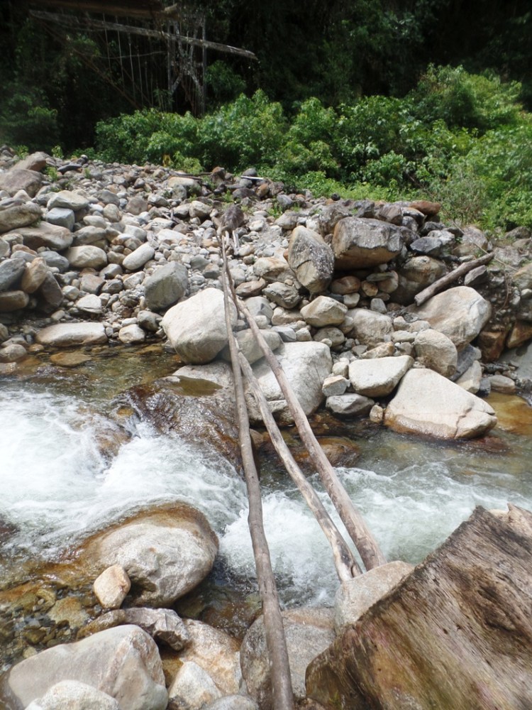
I could see on the app that there was a bridge around the corner though. Except that when I reached that location I merely found the remains of one which had collapsed.

This wasn’t a new situation to me. This kind of thing happens a lot in South America, a region of the world which is prone to earthquakes and landslides, and usually, if a new bridge has not been built yet there will be a detour to reach an alternative bridge. I spent the next hour walking back and forth, clambering around banks, venturing back up to the huts in El Choro and even backtracking along the trail for a while because I was convinced I must have missed something, but eventually I realised that I had no other choice but to take off my shoes and try to wade across the river. And pray that there was a trail somewhere on the other side (because I couldn’t visually see one).

I am not being dramatic in saying that it was dangerous. I was almost waist deep, it was a fast running river and the rocks beneath were slippery and I couldn’t see them properly. At one point I almost slipped and I was very conscious of the fact that I was alone and that if something happened to me there would be nobody to help or even know about it.

I did make it to the other side though, but some of my things got wet along the way. After putting my shoes back on, I clambered around a few different parts of the bank and eventually found a way back onto the trail.

I am very disappointed with the people in charge of this trek for this very irresponsible behaviour though. I went through two checkpoints and neither of the people there told me anything about it. Forewarning me would have not only saved me a very frustrating hour of my life but, more importantly, it is dangerous to have no indication of how to rejoin a trail again once it is broken. When people are lost they end up wasting time they may not have the food supplies for and climbing places they shouldn’t be.

SAMSUNG CAMERA PICTURES

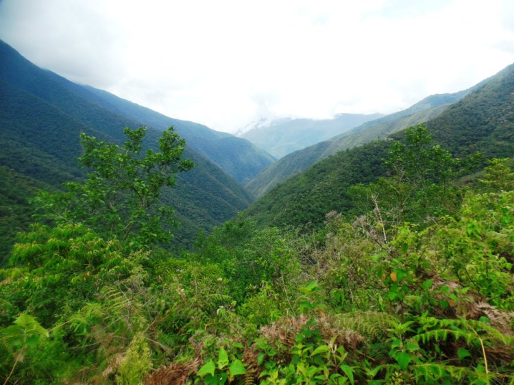
The trail went a little uphill after that, through the cloud forest. I encountered another broken bridge an hour later. This time they had improvised a somewhat haphazard replacement but I think that it would have actually been safer to wade this one too, to be honest. When I crossed it the logs were twitching beneath my feet and at one point one of them swerved a little. Someone is going to have an accident on it one day, but luckily it wasn’t me.

6.JPG

I reached San Francisco by mid-afternoon and it was one of the few campsites where the owner was actually present, but I decided to carry on a couple of hours longer to Bella Vista as there was still some daylight left.

SAMSUNG CAMERA PICTURES

When I reached the Bella Vista the three French guys were there and had already set up their tent. I was feeling in a more social mood that evening so I chatted to them more. They had experienced confusion when they reached that river too but, with there being three of them, crossing it was a bit easier.

9.JPG

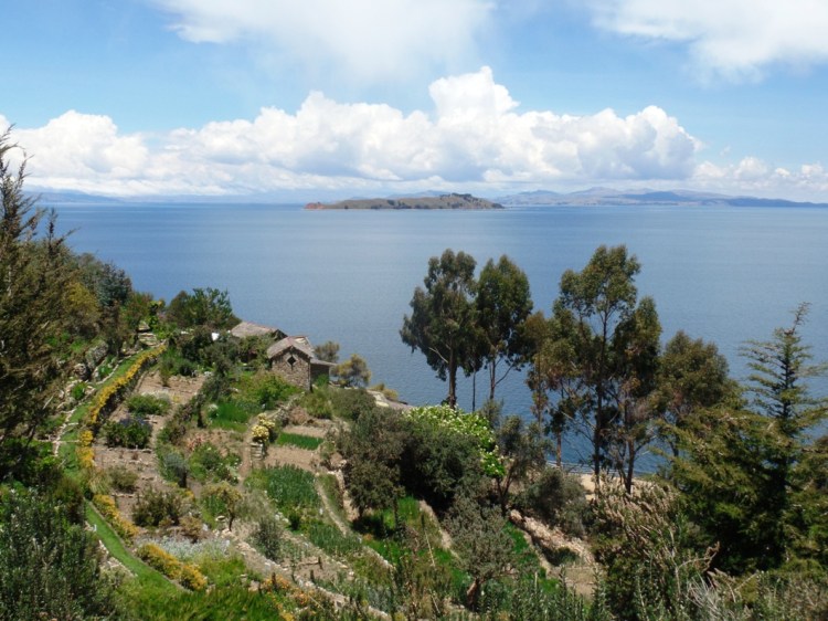
The third morning I heard thunder as I was packing away my tent and by the time I was on the trail, it began to rain. With it mostly being downhill that day I managed to keep up with the French guys for most of that day. We passed Sandillani, the final campsite of the trail, an hour in and met a Swiss couple who had spent the night there. Of all the campsites, Sandillani was the most beautiful – it had a garden overlooking the valley and lots of little cabins which used to serve several purposes – but it was also a sad place because the Japanese man who built it and lived there for fifty years recently died and the place has begun to fall into disrepair.

SAMSUNG CAMERA PICTURES

It began to rain heavier, so the French guys and I made our way. I put my cover over my backpack but didn’t put my raincoat on as it was fairly warm and I had not showered for a few days so I would prefer to be wet and refreshed than sweaty and clammy.

I didn’t get to take any photos for the rest of that day because my camera was stored safely within my backpack. It was pouring with rain and the views were obscured by clouds anyway. We made good progress, reaching Chairo before lunch.

Chairo is connected to a road but still quite far away from any public transport system, so we talked a man there who owned a minivan and negotiated a price to be taken to Coroico.

SAMSUNG CAMERA PICTURES

Overall, I have to admit that El Choro was not my favourite trek I have done over the last few months, but I did miss a lot of the views because I was there at the wrong time of the year. It was certainly good for birdlife and seeing some of the cloud forests of the Yungas though.


For more photos, click here.

Travelblog SA#28: La Paz – Bolivia

9th-12th November 2018

La Paz, the highest administrative capital in the world. Its official attitude sits at 3,600 meters, but in reality when you are here chances are you could be much higher than that, as it is perched within towering peaks. It’s airport, based in a district known as ‘El Alto’, is 4,100.

SAMSUNG CAMERA PICTURES

I will begin with the journey there from Copacabana. On the bus I often found my eyes drawn away from the book I was reading to the window as we circled the shore of the lake. At one point the bus began to sway and I was startled to see we were completely surrounded by water. The bus was floating upon a small vessel, being carried to the other side. From there, we ventured up into the mountains for a period of time until we crossed a threshold and were suddenly on a flat, desert-like plane which stretched for miles and miles with only the icy peaks of the Cordillera Real to be seen on the horizon.

As soon as you reach La Paz you are plunged into chaos. The bus crawls its way through unruly traffic on old roads full of potholes, but you are not overly upset about it because it is a vibrant city with lots of street markets.  I even spotted a group of people praying by a small outdoor altar with burning incense.

I was tired the day I arrived and I had things to catch up with online. The wifi in La Paz was somewhat more functional than in Copacabana but still painfully slow. I was staying in a small B&B on the tenth floor of a tower block overlooking the centre. It was a cosy little place with a kitchen, bathroom, two private rooms and one dorm with just four beds. The lady who owned it was helpful and one of the other guys staying there I had met previously before in Ollantaytambo, so I felt at home.

The next morning I began exploring. I started with the sights near to the central plaza. The cathedral is a little empty and bare, but it is the nearby Iglesia San Franciso which is the real nucleus of religious life. I have noticed so far during my time in  Bolivia that, unlike Peru, all of its churches have been free to enter.

3.JPG

Next to the church there is a museum where you can wander some of the halls of the old Franciscan Monastery. To be honest, there isn’t a great amount to see in there, but the entry does come with a free tour and the guides are helpful and inform you of some of the area’s history.

SAMSUNG CAMERA PICTURES

I went to visit El Mercado de las Brujas (Witches Market). A place where one can buy all sorts of remedies, potions, herbs, and even some more gruesome ingredients such as llama foetuses from old ladies if you wish. It was interesting to browse for a while, but it seems the street is beginning to be taken over by travel agencies and stalls selling tat which is somewhat polluting the ambience.

SAMSUNG CAMERA PICTURES

I spent the rest of that day in museums. The Museo Nacional de Etnografia y Folklore had a wonderful collection of ceremonial masks and examples of weaving, pottery, featherwork and all over affair from the different regions of Bolivia. It is a lovely way to spend an hour and soak up Bolivia’s wonderfully diverse culture, but I did come out of there feeling a little peeved that, despite them acknowledging their foreign visitors in a monetary way, by having a perfectly-translated list of rules and entry prices at reception and charging us four times the amount they do nationals, once you have bought your ticket, you discover that none of its displays has any information in English.

SAMSUNG CAMERA PICTURES

The Museo Nacional de Arte was technically closed that day because they had a temporary exhibition by contemporary artists from all over Latin America. This event was free entry and, once inside, I managed to see some of the museum’s permanent displays too because the doors were left open.

SAMSUNG CAMERA PICTURES

The next day I set off early in a crowded minivan to see Bolivia’s most important archaeological site, Tiwanaku.

SAMSUNG CAMERA PICTURES

Pre-dating the Incas by hundreds of years, the Tiwanaku people are one of the most interesting in all civilisations of South America. From their humble origins on the shores of Lake Titicaca, they managed to spread across a vast region encompassing parts of Peru, Bolivia, and Chile, and what makes that even more of an enigma is that archaeological evidence suggests that this expansion was achieved peacefully with very little warfare.

SAMSUNG CAMERA PICTURES

This site was their nexus during the civilisation’s golden age. Its stones were carved from quarries in Lake Titicaca and hauled all the way up by a very early canal system. It is thought they chose this location, despite its harsh location, climate and lack of fertile soil, because the Tiwanaku were astronomers and it is situated upon a flat plane, allowing them to better observe the movements of the stars. Indeed, one of the pyramids they built – now not more than a mound surrounded by some vestigial walls – was thought to have had a pool on its roof for their holy men to see the night sky in its reflection, and there is also the Sun Gate which acted as a primitive calendar.

SAMSUNG CAMERA PICTURES

The Tiwanaku people did not meet their end through being conquered but experienced a long period of drought, during which their civilisation dwindled. The ones who survived retreated into little villages because life was so hard they no longer had the luxury to build monuments or map the universe. Tiwanaku was abandoned, but many of its people were swept up by the Incas and I don’t think there is much mystery – particularly when you see sights such as the nearby Puma Punku – as to whom they learned their master stone-crafting techniques from.

SAMSUNG CAMERA PICTURES

On the way back to La Paz, instead of being caught in all the traffic again I got off the bus and used one of its cable car systems to reach the centre. It was a wonderful way to see the cityscape, passing over all of its rugged peaks and outer neighbourhoods. I even got to see the famous market in El Alto, said to be one of the biggest in Latin America.

SAMSUNG CAMERA PICTURES

On my final day of exploring La Paz, I went for a little trip to Valle de la Luna which was just a short bus ride away and had some very interesting formations. It was a great way to spend my last morning before I prepared for the El Choro trek, which is what my next blog will be about.

SAMSUNG CAMERA PICTURES


For more photos from La Paz, click here.

Travelblog SA#27: Lake Titicaca Part 3 (Copacabana, Isla del Sol & Isla de la Luna) – Bolivia

6th-8th November 2018

For the third part of my time in Lake Titicaca, I crossed over the border into Bolivia. A country I will spend the next five weeks exploring. I swiftly noticed a very different ambience in the air. Bolivia’s standard of living is lower than Peru’s, and it was like travelling back in time a little. The streets looked older and were a little less maintained. Hotels advertised that they had hot water like it was a luxury. Men pushed wheelbarrows filled with vegetables down the street. There was a certain charm to it all. Not that I am glamorising poverty, I just think that everywhere has its own allure and countries shouldn’t be written off just because they are not quite as clean and comfortable by first-world standards.

SAMSUNG CAMERA PICTURES

Copacabana, the primary base for exploring Lake Titicaca from the Bolivian side, is quite different to Puno. It is just a small town and, whereas Puno has multiple industries, Copacabana seems to survive almost exclusively from tourism. It was certainly much more postcard-worthy. I particularly liked its cathedral just by the main plaza and it was the first place I visited.

SAMSUNG CAMERA PICTURES

My first day, I focused upon exploring the sights just a stone’s throw away. After wandering around the Cathedral, I went to Horca del Inca just outside of the town. It involved a steep climb but there were lots of interesting rock formations along the way.

SAMSUNG CAMERA PICTURES

As well as wonderful panoramas of Lake Titicaca.

SAMSUNG CAMERA PICTURES

The main feature of this hike though is an old astronomical observatory. This site has a  misleading name because it is actually a pre-Inca site built by the Chiripa people, who held ceremonies here during the winter solstice when the sun is aligned with the opening in these stones.

SAMSUNG CAMERA PICTURES

Later in the afternoon, I climbed up Cerro Calvario which is on a peninsula overlooking the lake. It is a famous spot for watching the sunset but on that evening it was cloudy. Bolivia is entering its rainy season, so it is not the best time of the year for clear skies. It is not too wet yet though and one good thing about visiting this time of the year is that it is less crowded.

SAMSUNG CAMERA PICTURES

There were some great views overlooking the lake though, and the sunset, even if you couldn’t see it fully, did cast some interesting textures on the horizon. I drank my first Paceña – one of Bolivia’s national beers – and watched it for a while before making my way down to Copacabana.

SAMSUNG CAMERA PICTURES

The next day I went on a day trip to Isla del Sol. Originally I intended to spend the night on this island, but then I found out that most of it is currently closed off due to an ongoing conflict. It seems that tourism, and all the money it brings, has changed this community. Those of you who read my blog regularly will be aware that I am not one to shy away from calling out poor behaviour of first-world people when they visit other countries and how they sometimes ruin them, but this is one of the rare occasions where it appears that the fault of the tourists rests no further than their mere presence, and it is primarily the behaviour of some of the locals which is to blame.

I have both done some research online and spoken to some of the residents of Copacabana about this issue, and it seems there are many complex reasons for the developing of this feud. Tensions did begin, rather predictably, with money. Tourists are charged an admission to enter the island (which is fair enough, as we are coming in hoards and there is a certain amount of maintenance involved when a community gets bombarded by visitors). Eventually, some of the locals began imposing their own extra fees upon visitors walking the pathways which connect the north and south of the island. Because these charges were not actually authorised or regulated by any particular official authority, some of the other locals (quite rightly) got annoyed because this money was just going into the pockets of rather greedy individuals instead of benefitting the community.

Amid this building tension, a catalyst occurred. The story I was told was that some of the members of the northern side of the island built new cabanas for tourists near to a site which members of the central community considered sacred, and then said members of the central community retaliated by blowing up the cabanas with dynamite.

Ever since tourists have only been allowed to the south of the island and both the centre and north have been declared off limits until this feud has been resolved.

With only the south being accessible, it is very debatable whether it is worth spending a night on Isla del Sol now. On places like Tripadvisor people seem very polarised. Half say it is one of the most beautiful places they have been to in South America and staying the night is absolutely compulsory to get the full experience, while the other half say that it is a tourist trap where you get constantly harassed all day and there isn’t much point in staying because most of the island is closed. There isn’t much middle ground…

I was very torn by all this conflicting information, equally driven to stay overnight or just do it as a day trip. What eventually swayed it for me, was finding out about the way the boatmen behave, which I will now explain.

When you buy your ticket from Copacabana to see the islands, the price is quite cheap. A return is only slightly more expensive than a single if you are coming back the same day but, for some reason, they do not sell returns for the following day if you wish to stay overnight. I have heard reports from other gringos that people who stay overnight are often taken advantage of by the boatmen who inflate the price for the journey back by more than 50% of what they paid for their original journey there, knowing that the tourists have no other choice but to pay or be stranded.

So in the end, I decided to leave my stuff behind in Copacabana and just go as a day trip.

SAMSUNG CAMERA PICTURES

The next morning, I and the other people on the boat were first taken to Isla de la Luna, Isla del Sol’s smaller sister. It was once home to an Inca nunnery of sacred virgins and some of the relics from this epoch remain.

SAMSUNG CAMERA PICTURES

You are only given an hour on Isla de la Luna but with it being so small it is enough and you have plenty of time to explore the ruins and walk across its spine for some beautiful panoramas. To the west, you can see Isla del Sol.

SAMSUNG CAMERA PICTURES

To the south, peninsulas from the mainland.

SAMSUNG CAMERA PICTURES

And, to the east, apparently you can usually see the white peaks of the Cordillera Real, but they were covered in clouds that day.

SAMSUNG CAMERA PICTURES

After our short time on Isla de la Luna, we got back onto the boat and were taken to Isla del Sol.

SAMSUNG CAMERA PICTURES

Of all the islands I have been to on Lake Titicaca, Isla del Sol hands-down wins the award for being the most picturesque. There really isn’t any competition.

SAMSUNG CAMERA PICTURES

During the two hours I was given to wander, I did manage to see most of what the south of this island has to offer. I climbed its two highest peaks, explored Yumani (its main village), and also walked through a forest.

15.JPG

I didn’t bother walking to Pilko Kaina – the Inca ruins – though, as I saw them from the boat on the way in and they didn’t seem worth the long walk when there were such stunning views everywhere else on the island.

SAMSUNG CAMERA PICTURES

So  I found the time doing it as a day trip just enough. But if you are reading this trying to make the same decision, bear in mind that I am a fast walker and even I felt a little rushed. A part of me felt that it would have been nice to be able to take my time and relax there overnight, but my wallet was certainly happier that I came to Copacabana, as accommodation and food are much cheaper there. I also didn’t have to deal with the boatmen the next day.

SAMSUNG CAMERA PICTURES

Did I make the right choice? I am still not sure, to be honest. I can’t give you a straight answer over the ‘stay or go’ argument. Like I said, Isla del Sol is the most beautiful part of Lake Titicaca, but what others have said about it being touristy is also true. Like most places, Isla del Sol is complex. It has many sides to it and many different people you may end up interacting with. And thus, your experience there is partly based on luck and who you bump into. I do hope that Isla del Sol recovers from its rough patch and the community learns to adopt tourism in a healthier way.

SAMSUNG CAMERA PICTURES

For jaw-dropping beauty, Isla del Sol is a must-see, whether you stay overnight or not but, if you wish to see island culture on Titicaca in a more authentic form, then I do suggest visiting Isla Amantani (on the Peruvian side). Have the best of both worlds and see them both.


For more photos from the Bolivian side of Lake Titicaca, click here. To read about my journey on the Peruvian side click here for Part 1 and here for Part 2.