
2nd – 6th June, 2023
I mentioned in my last blog that I travelled through Colombia quicker than intended and found myself with some time to spare. My flight from Bogota to Guatemala is booked for the 13th of June – giving me almost two weeks merely to explore Colombia’s capital – so I decided to look into other opportunities that could be found on the way there.
I opened up Google Maps on my phone, scanned the area between Santa Marta to Bogota, and I noticed that I had a place called Barichara bookmarked. It took me a while to remember how it had got there because it wasn’t a place I remembered reading about. I think it was either Mari and Tom – the Belgian couple I met during my first week in Colombia at Tierradentro – or Sergio – a friend of a friend I met at a soiree in Santiago – who recommended it to me.
After further reading, I discovered there was more than just Barichara this area had to offer. It was in the Chicamocha Canyon region: home to several other villages connected by a trail one can hike over two to three days. Perfect.

When I arrived in San Gil – the nearest town – I swiftly realised that this was primarily an adventure sports hub and that I, as a hiker, was a minority. The hostels here seem to all operate on the same model: lure people in with cheap rates for accommodation and then push a bunch of tours on them (which is where I suspect they make most of their money). Some of them were tempting, but they all ended up being beyond my interests, frugal budget, or fear of heights.

Despite this, the first hostel I stayed was still kind enough to agree to look after my big backpack for me, and the next day I caught a bus to Barichara with just a daypack full of the bare essentials.
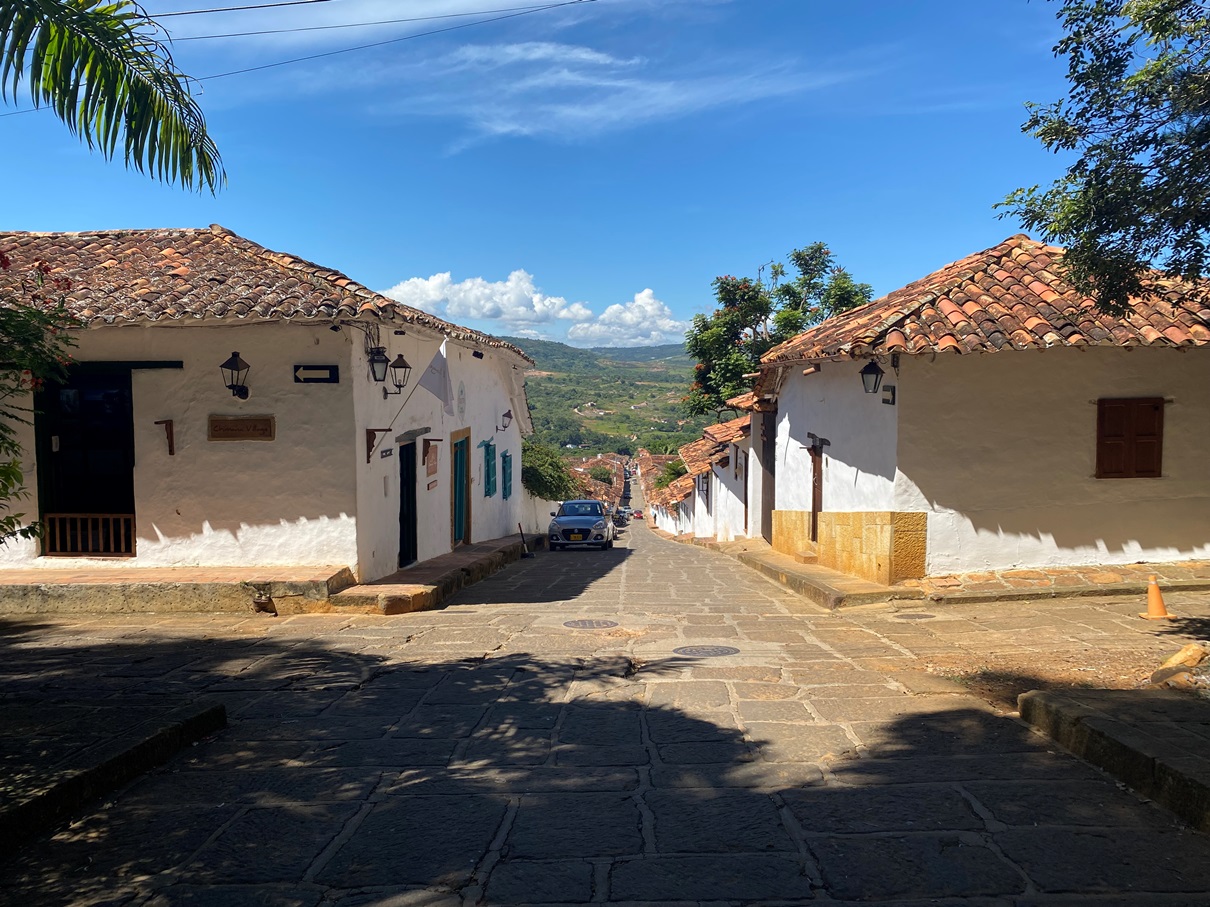
I spent some time exploring Barichara before beginning the hike. It was a lovely place. Not just for its architecture and old churches, but also the vistas that can be seen from the western side, overlooking the Suarez Valley.
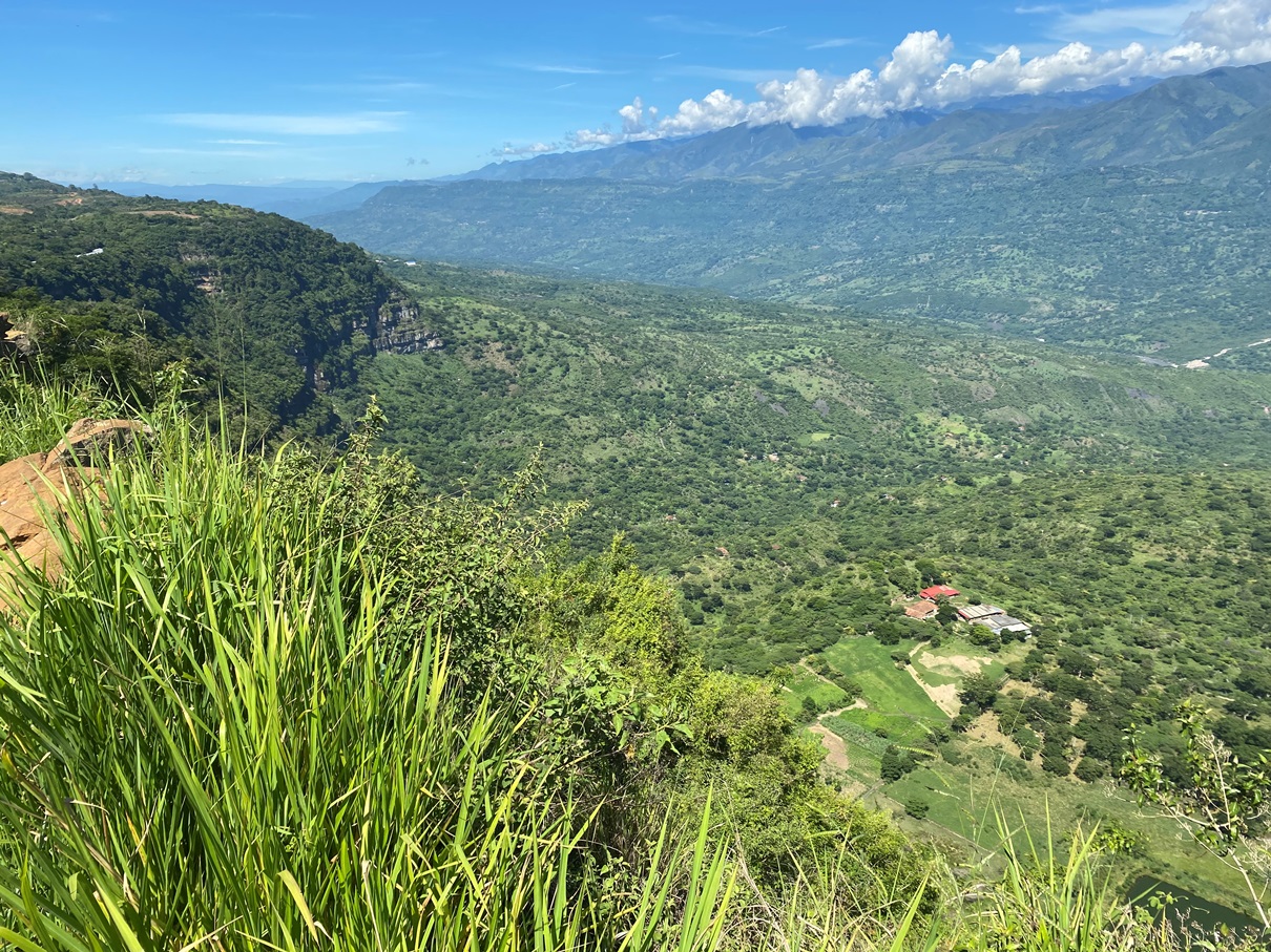
And this isn’t even the main vein of the Chicamocha Canyon (that is to come on the second day of this trek).

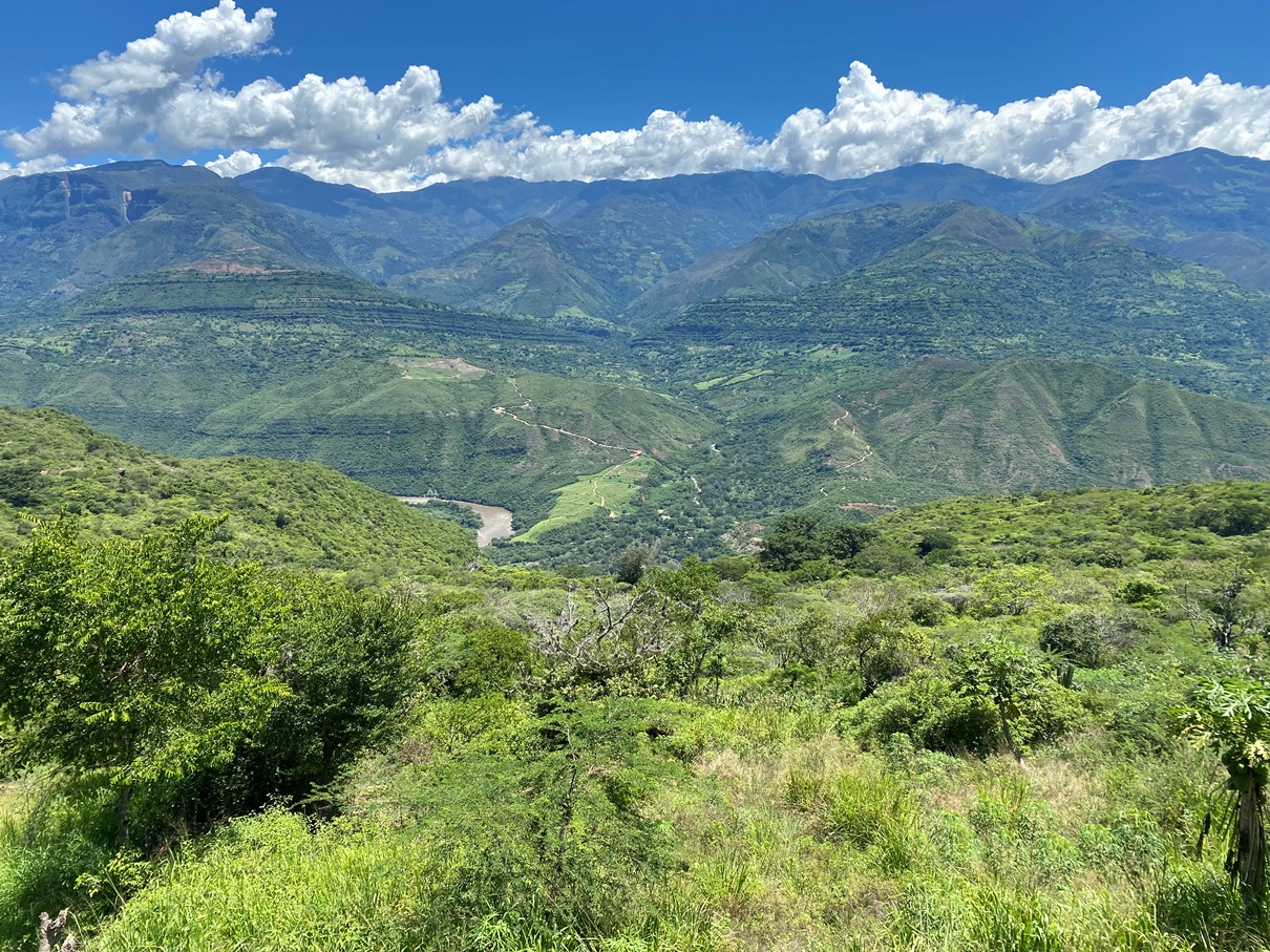
I was surprised by the quality of the trail too. It was an old cobbled road – some of it even lined with walls – and I passed some abandoned homes and farmsteads along the way.

The views were stunning throughout.

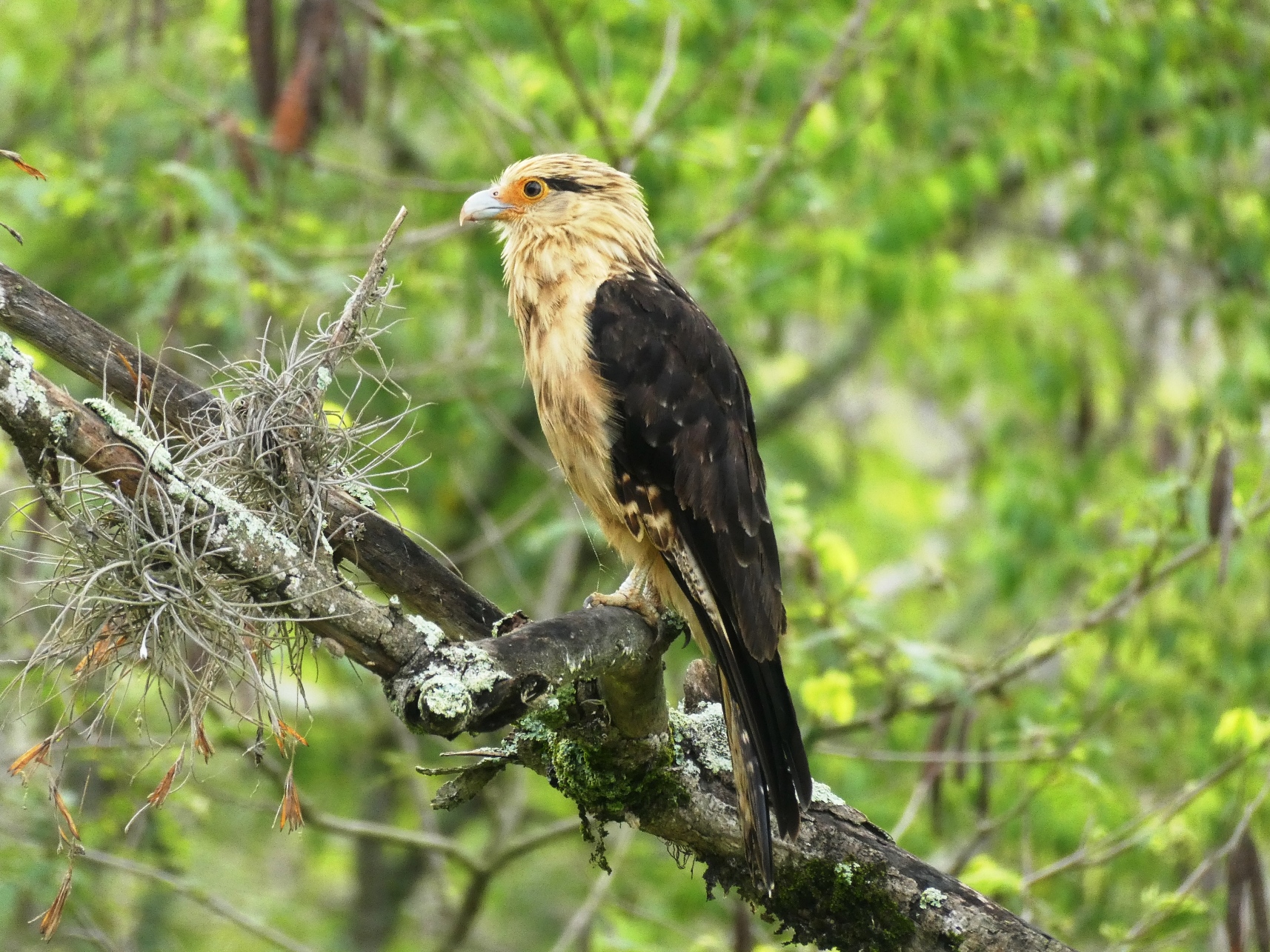
And it was surprisingly good for birdlife too. Many were flighty, but I managed to capture some with my digital camera.
It took me about two hours to reach Guane. Not as many people come to this place, but it is just as picturesque – if not more – as Barichara and the villagers seem very welcoming to the ones who do.

I passed by a shop where a woman sold homemade creamy liquors made from goat’s milk called ‘buratá’, and bought some. There was also another mirador overlooking the valley, and I stopped there for a while, ate lunch and hydrated myself whilst waiting for the midday sun to pass.
And then, after a quick walk through the plaza, I made my way along the next part of this trek: the trail to Villanueva.

Whereas most of the walk to Guane had been a gentle slope downhill, this was uphill. It wasn’t too steep, but it being the afternoon meant that it was hotter. I passed many more farmsteads along the way (but most were still inhabited).

And when I reached the top, I found myself looking down on Villanueva.

Despite being a much newer town than Barichara and Guane, I found it quite charming. I got myself a room at Hostel San Juan – which was very reasonably priced – and went to have dinner before getting an early night’s sleep.

Knowing I had a long day ahead, I rose early the following morning and ate a few breakfast bars before heading back along the trail again.

It took me an hour or so to reach the actual canyon. Before that, it was more farmsteads along a dirt track road. I was quite blessed with the weather; in the morning, it was overcast, so the air was cool. I had heard that one of the main enemies of this trek – like many in Colombia – is the sun and heat.
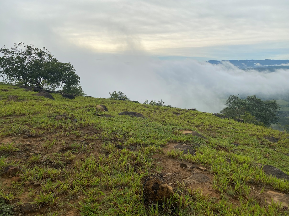
I was, however, a little worried that all these clouds would obscure the view of the canyon, but they cleared up a little when I reached the first mirador.

As I made my way down, the fog continued to waft across the canyon, occasionally clearing up just enough for me to appreciate the view and take some photos.

The fog was also a blessing when I reached the knife-edge part of the trail, as it eased vertigo I usually feel during such moments.

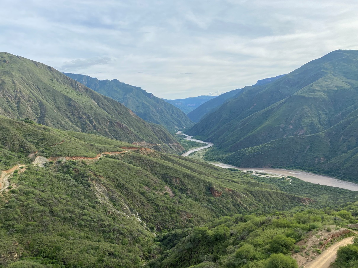
By the time I had reached the bottom, the mist had cleared completely, and I stopped at the village of Jordán to eat a snack and hydrate myself but didn’t linger for too long. It was 10:30 am, and I still needed to hike out of the canyon. I wanted to get as far as possible before the midday heat hit.

I had read online that this trail back up the canyon is not too steep and… that is sort of true. I have certainly done much worse. The Colca Canyon in Peru comes to mind as one that was far tougher. The trail is yet another cobbled road, and it has plenty of shelters along the way where one can rest in the shade (whilst enjoying the view).

But, despite this, you are still essentially climbing an elevation of almost a thousand meters in just a few hours, and I greatly underestimated the toll this would take on me. Most people rest in Jordán overnight and hike this in the morning, whereas I was doing it at midday – after just spending four hours climbing down the canyon, no less. I had to take many rests along the way, and I was glad I brought plenty of water.

Once someone reaches the village of Los Santos at the top of the canyon, there are two options for getting back to San Gil; either by catching a very slow bus to Piedecuesta (which has connections to San Gil) or taking a shortcut through a cable car system several miles away. I chose the latter option – as I wanted to take the more scenic route – but the logistics of this were frustrating. There is (puzzlingly) very little public transport, and the locals I asked sent me on a bit of a wild goose chase to a series of places they thought might have colectivos but ultimately didn’t. In the end, I had to catch a mototaxi.

The cable car, however – when I did reach it – was one of the best I have ever been on. I got to descend into a whole other part of the canyon and back out again (but this time whilst sitting back and watching it all go by).
After this, I returned to San Gil and relaxed for a couple of days before heading to Bogotá.
Overall, I am very glad I came here and I am also greatly surprised that somewhere not even on my radar ended up being a highlight of Colombia. The San Gil area is certainly on the backpacker circuit as a place for adventure sports but not very well known for hiking. I know many other people have done it (because there are guides online, and the route is on Maps.me) but it doesn’t seem to be as popular as it should be. I had the trail to myself for the entire two days and didn’t come across another gringo.

If you would like to see more (stunning) photos of this area, click here.
